The Marine Exchange of Alaska (MXAK), a non-profit organization based in Juneau, supports safe, efficient, and environmentally responsible maritime operations in Alaska’s remote andoften perilous waters by providing critical information to the maritime community.
In efforts to prevent maritime disasters, the organization has established an extensive vessel tracking system using an Automatic Identification System (AIS). A significant number of recreational and commercial fishing boats under 65 feet voluntarily use AIS for their own safety. Commercial vessels larger than 65 feet and all vessels greater than 500 tons (300 tons for international voyages) are required to carry AIS while in Alaska waters.
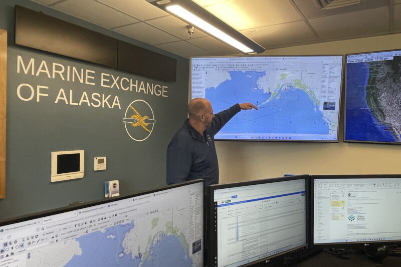
MXAK currently operates 147 land-based AIS receiving stations that send millions of vessel position reports per day to their 24/7 Maritime Operations Center. There, Maritime Information Specialists stand watch and monitor a live-stream of vessel movements. If they observe something unusual, such as a ship not under command, entering an Area to be Avoided, or traveling under 3 knots, they communicate with the captain to ascertain problems, and notify the Coast Guard if necessary.
Many of the MXAK crew are Coast Guard veterans experienced in marine rescues, further reinforcing their dedication to their work. “The teamwork and can-do attitude that our staff displays has truly enabled some significant success throughout the State,” remarked Executive Director Steve White.
With AOOS funding, the organization has installed and maintains 69 weather stations throughout the state. Several new land-based installations were recently completed in the Bering Sea, including new stations at the remote locations of St. Paul and St. George Islands.
“While AOOS and the Marine Exchange do great work independently to improve safety throughout Alaska, together we maximize our benefit and influence,” said White.
Data gathered from the weather stations is transmitted over AIS, providing mariners with local real-time information pertinent to their travels. Additionally, the environmental information is made available on MXAK’s website, the AOOS Data Portal, and the National Data Buoy Center website, where it can be easily accessed by the National Weather Service, aviators, and others.
MXAK also operates two mobile weather stations hosted on state research vessels. They plan to install six more on Alaska Marine Highway ferries. Environmental data collected “on the go” in remote areas will help inform mariners operating or planning to transit those areas and will further aid regional weather forecasts.
With support from AOOS, the Marine Exchange of Alaska is also testing time-lapse web cameras that provide a time series of sea state and atmospheric conditions, allowing users to visually assess changing conditions over a period of several hours.

Executive Director Steve White explains the Marine Exchange of Alaska’s automated vessel tracking system that is monitored around the clock in Juneau. Photo by Alice Bailey.
