Increasing Weather Observations with AIS
Location of the Data
The Need
This project enhances maritime safety and environmental protection in Alaska by providing real time weather information to vessels over the AIS (Automatic Identification System). AOOS supports the Marine Exchange of Alaska to establish joint installations for AIS and weather observations across the state, making it possible to disseminate localized, real time weather observations through the AIS communication system directly to vessels operating in the vicinity of a station. Most commercial vessels are required to be equipped with AIS by the International Maritime Organization (IMO) treaties, making AIS one of the most reliable means of communicating weather and other environmental information (e.g., ice reports, waves) to vessels operating in coastal waters out to 50 nautical miles offshore. Real time weather outputs from these AIS/weather stations are also available for use by NOAA’s National Weather Service (NWS) in their regional weather forecasting activities. This effort is helping fill critical data gaps in real time operational weather in Alaska, especially in the Arctic.
Project Location
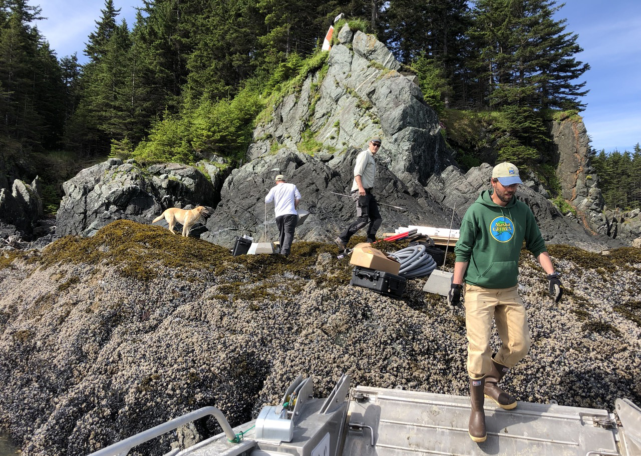
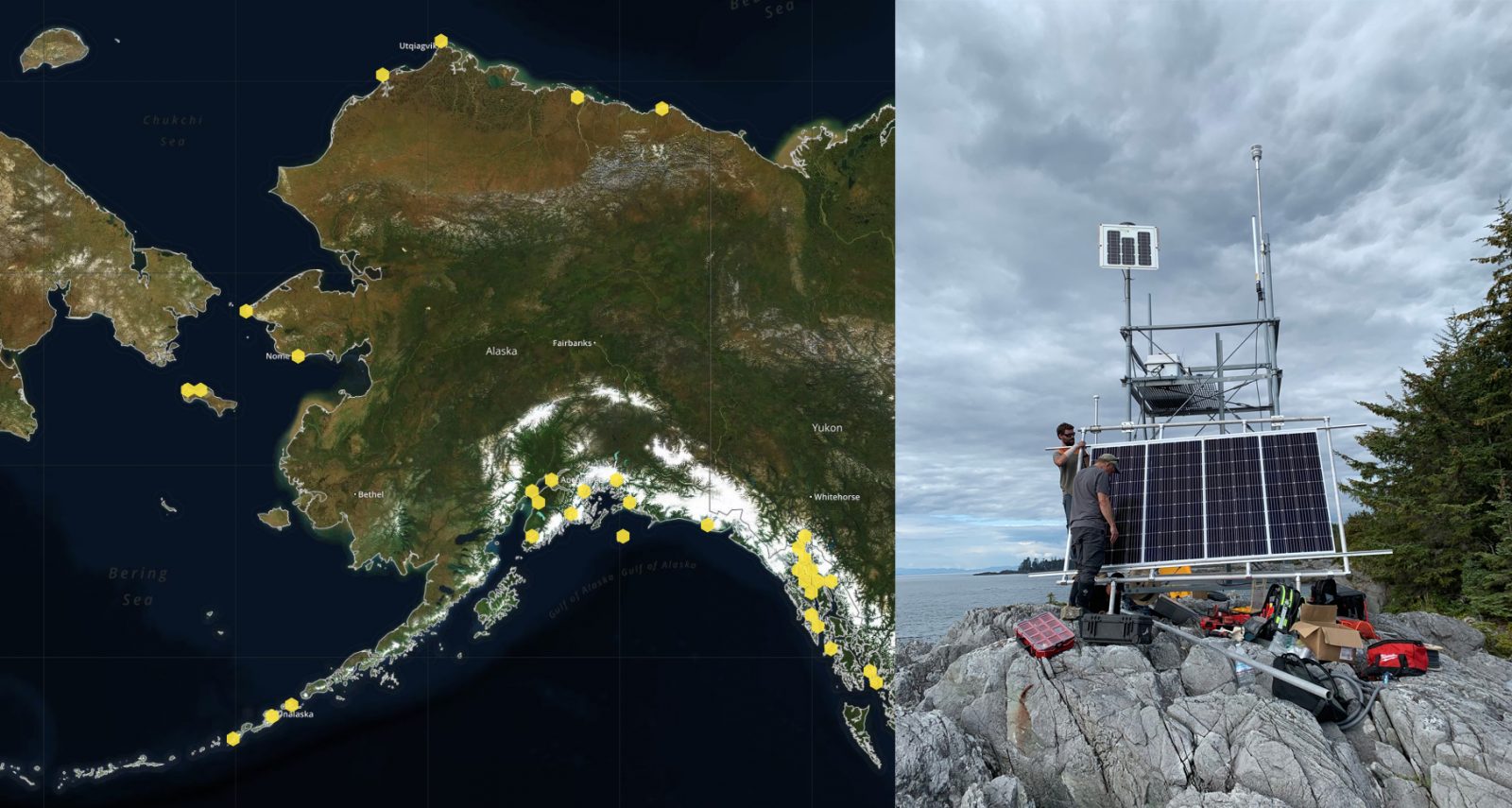
AOOS currently supports over 40 Marine Exchange weather stations in Alaska. Recent efforts are aimed at increasing real time observing capability in the Bering and Chukchi Seas as well as the eastern Beaufort, with four new stations installed on St. Lawrence Island (Gambell and Savoonga) and in the communities of Wainwright and Kaktovik during 2018-19. Additional installations are planned for 2020 in several Bering Sea locations, including Shishmaref, St. Paul and St. George Islands. A real-time sensor map below shows the AIS/weather station locations as of April 2020. All of these stations are installed and maintained by the Marine Exchange of Alaska.
Project Details
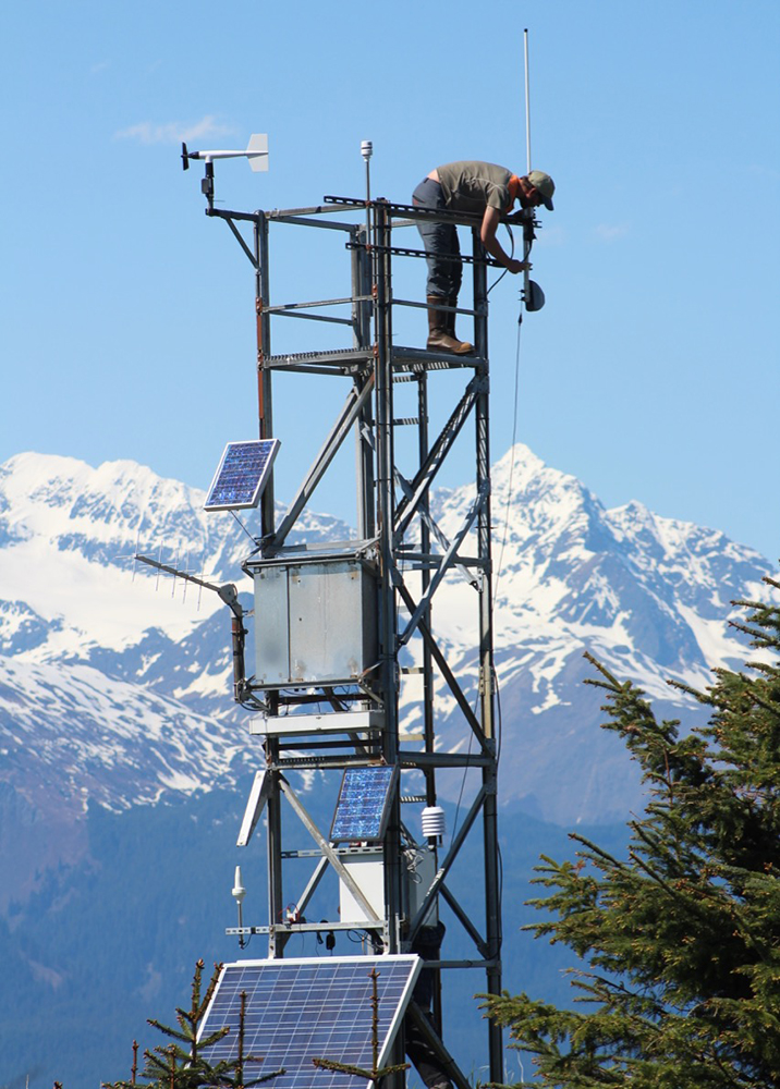
The Marine Exchange of Alaska (MXAK) builds and operates the only terrestrial AIS network in Alaska that is serving as the primary component of the U.S. Coast Guard’s and State of Alaska’s maritime domain awareness network. The MXAK is internationally recognized as having some of the most extensive maritime domain expertise in region. The MXAK AIS network currently has over 120 AIS receiving stations, of which over 50 are located in the Arctic, a region encompassing the Bering Sea north of the Aleutian Islands up through Bering Strait, across the Chukchi Sea and into the Beaufort Sea as far as the Canadian border. Though AIS technology is traditionally used to track vessels for collision avoidance, AIS was also designed to communicate safety and environmental information to mariners. The MXAK has worked with the U.S. Coast Guard (USCG) in a Cooperative Research and Development Agreement (CRADA) to develop and demonstrate the Arctic Next Generation Navigational Safety Information System, which utilizes AIS transmitters to send environmental and safety information to mariners to aid safe and environmentally sound maritime operations.
Initially with AOOS support, the MXAK tested and developed the technology to obtain and transmit environmental information to mariners via AIS and the internet accessible by smart phones and/or computers. AOOS now continues its support through investments in weather sensors and weather station installation efforts.
All real time data are made available to the NOAA National Weather Service (NWS) to aid forecasting and the dissemination of real time weather information via their VHF broadcast and web notification system. Though the primary focus of this project is to provide direct weather information to mariners opearting at sea, the NWS is consulted by AOOS when selecting additional sites for weather installations of any kind, including AIS weather stations. Several AIS weather installations are also reported out through the National Data Buoy Center (NDBC) data portal. All AIS weather data are publicly available through the AOOS Ocean Data Explorer data portal, both in real time and as historical data dating back to 2015.
Project Highlights
This project has successfully applied AIS technology towards attaining the AOOS goal of supporting navigation safety and marine commerce, while providing operational real time information for improved weather, climate and marine storm-surge forecasting. The technological solutions will be shared with other interested IOOS members for nationwide application of this capability, giving this project the potential to enhance maritime safety throughout all the IOOS regions.
Funding Sources & Partners
> AOOS
> Marine Exchange of Alaska
> City and Borough of Juneau
Resources
- MXAK Weather Webpage
- Video of a MXAK Weather installation trip
- AOOS Real Time Sensor Map for MXAK AIS/Weather Information
- NDBC Weather Station
Publications
Wright, D., C. Janzen, R. Bochenek, J. Austin, E. Page, 2019. Marine observing applications using AIS: Automatic Identification System. Front. Mar. Sci. 6:537. Doi 103389/fmars.2019.00537
Principal Investigators

MXAK Executive Director

MXAK Project Coordinator