Arctic Oil Spill Assessment
Using AIS and subsistence use data for decision support
Results
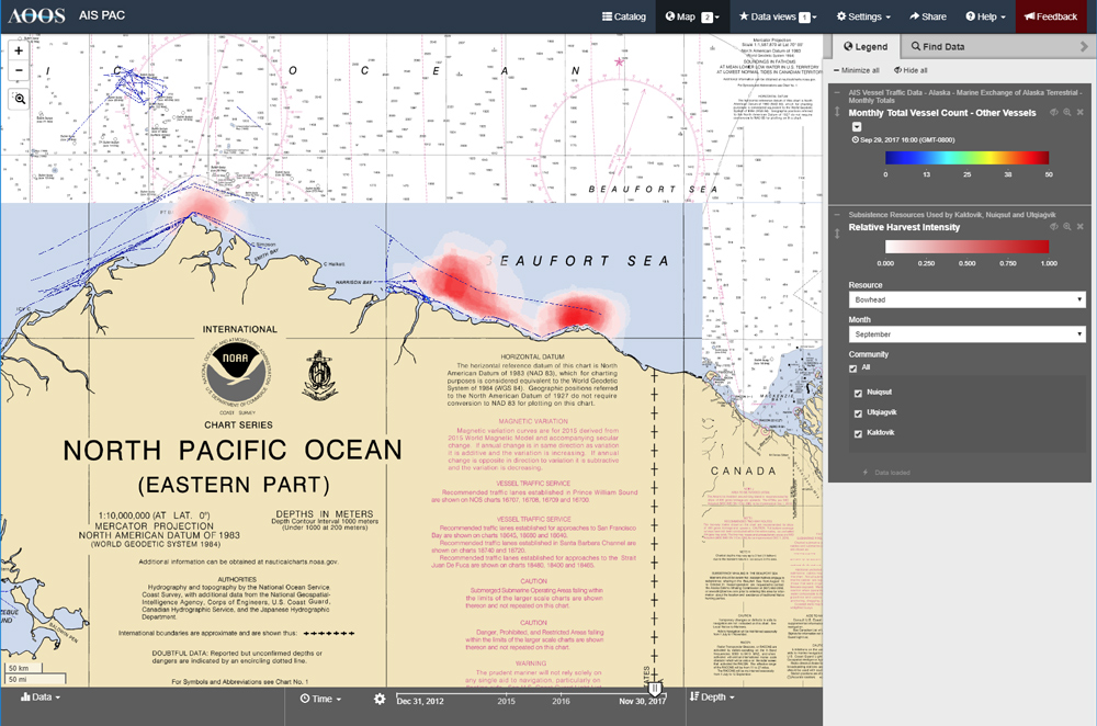
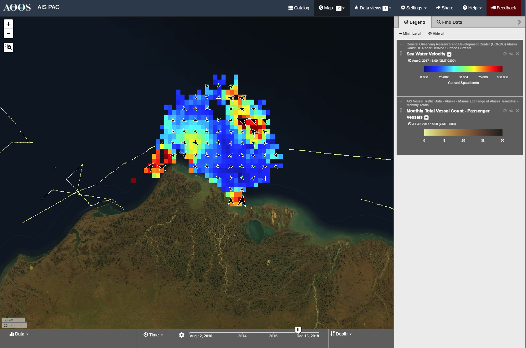
The two-year project ended in November 2018 and resulted in the development of a data portal and interactive mapping tool, three unique data products (vessel traffic density maps, subsistence harvest areas, and oil spill risk analyses), and 556 unique data layers that are accessible for preview and download.
Project Title
Synthesizing AIS ship tracking data, GNOME oil spill model results, and subsistence use information into a unique, interactive tool to aid research and planning in coastal communities bordering the Alaska Beaufort Sea.
Project Summary
This project integrated data products describing vessel traffic patterns, estimated oil spill impacts, and subsistence use data from the communities of Utqiaġvik (formerly Barrow), Nuiqsut, and Kaktovik along the Beaufort Sea coast, and incorporated them into a unique tool for planners and subsistence community members. Spatial heat maps of vessel traffic density were developed by analyzing Automated Identification System (AIS) data from the Marine Exchange of Alaska and NOAA to isolate marine vessel corridors experiencing the heaviest traffic. Investigators ran over 100,000 oil spill trajectory scenarios powered by ocean circulation and atmospheric wind models initialized at locations and times corresponding with historical vessel traffic. Spill trajectory results were summarized to produce a spill impact density map for the Beaufort Sea. Subsistence use patterns were produced by aggregating individual subsistence mapping, harvest, and other socio-economic surveys from the Alaska Beaufort Sea communities of Utqiaġvik, Nuiqsut, and Kaktovik. These previously unavailable subsistence datasets include species descriptions, timing and area for targeted species, and other traditional ecological variables for each community. The subsistence mapping and species distribution data were compared to the spill impact density maps to estimate how different subsistence activities and their relative timing could be impacted in the event of a spill. The data gathered and synthesized through this project are now publicly accessible through an interactive web-based mapping tool as a mechanism for increasing public, private sector, government, and community knowledge about possible spill effects to subsistence uses in the US Arctic.
Background
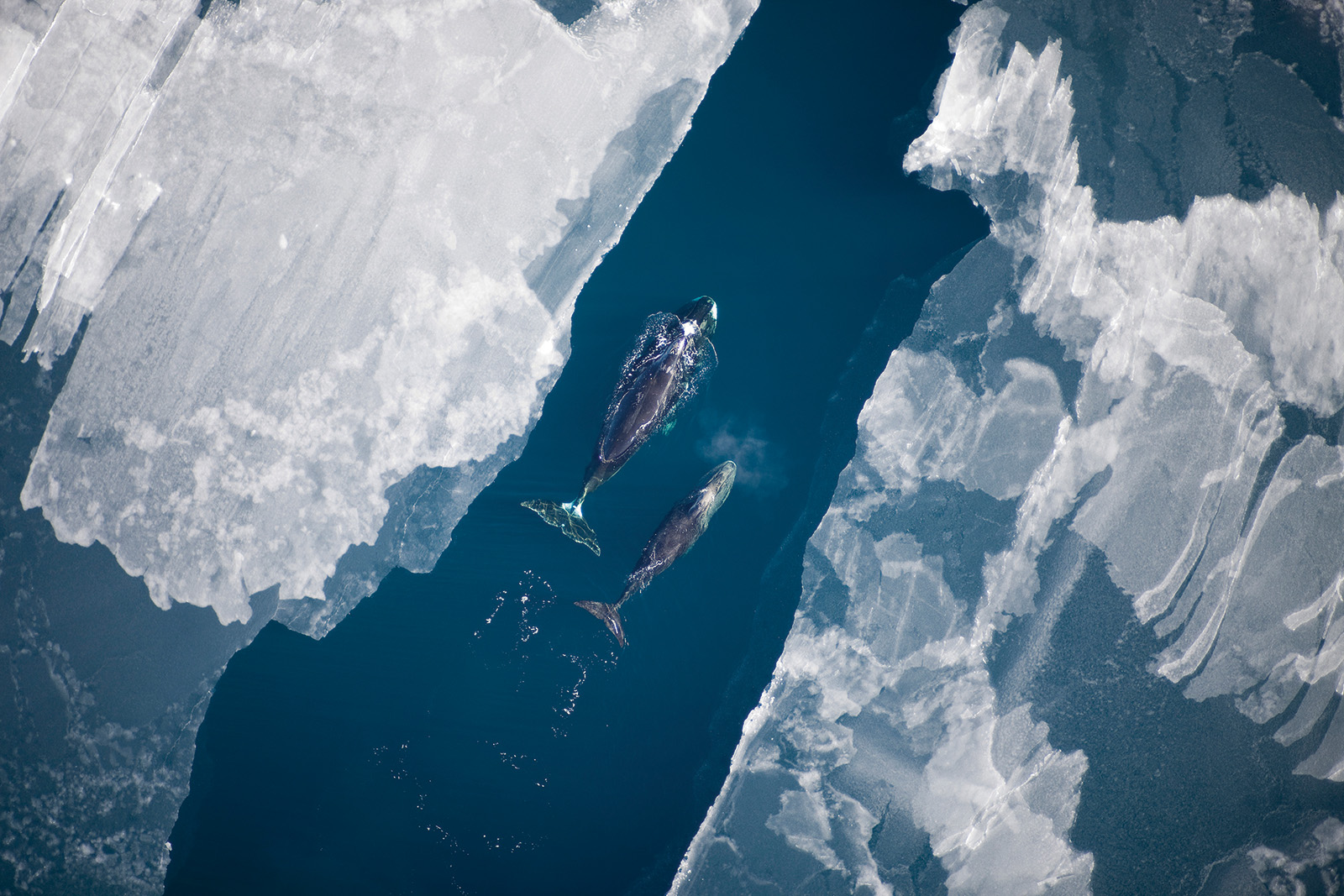
Climate conditions are undergoing rapid changes in the US Arctic, the effects of which are widely recognized by coastal communities in Alaska. Coastal erosion rates have doubled along the Beaufort Sea coast since the middle of the 20th century, with increases in the number of ice-free, open water days and higher rates of permafrost warming both contributing to accelerated coastal erosion. Customary and traditional uses of fish and wildlife are important to the economic and cultural livelihoods of Northern Alaskan communities in the Beaufort Sea. Resources that Alaska Native communities depend upon for subsistence purposes are vulnerable to the effects of a changing climate.
Climate conditions are undergoing rapid changes in the US Arctic, the effects of which are widely recognized by coastal communities in Alaska. Coastal erosion rates have doubled along the Beaufort Sea coast since the middle of the 20th century, with increases in the number of ice-free, open water days and higher rates of permafrost warming both contributing to accelerated coastal erosion. Customary and traditional uses of fish and wildlife are important to the economic and cultural livelihoods of Northern Alaskan communities in the Beaufort Sea. Resources that Alaska Native communities depend upon for subsistence purposes are vulnerable to the effects of a changing climate.
Funding Sources & Partners
> Marine Exchange of Alaska
> Arctic Domain Awareness Center
> National Academy of Sciences Gulf Research Program Synthesis Grant Award # 2000007630
Shrinking sea ice cover in the Arctic has fostered increased socioeconomic activity, such as increased ship traffic and oil exploration. Sea ice coverage has decreased to the point that existing northern shipping lanes around the world are open longer and are projected to experience increased marine vessel traffic. Increased traffic in turn increases the probability of accidents and potential for oil spills posing dangers to subsistence resources and the coastal environment. A spill in this region would be catastrophic to communities and difficult to respond to because of the Arctic’s remoteness, harsh environmental conditions, and lack of sufficient facilities or ports for response.
There are currently only three US marine ports on the Beaufort Sea — Wainwright, Prudhoe Bay, and Bernard Harbor — all of which are classified as “very small”, and thus, insufficient to respond to major spills. A small cache of local spill response equipment is present in Utqiaġvik, but it is minimally outfitted for a spill volume of less than 5,000 gallons of oil. A larger inventory of response equipment resides in Deadhorse, at Prudhoe Bay; however, that equipment is meant for spills from local oil and gas operations, not to be dispatched along the entire 400-mile coast from Utqiaġvik to Kaktovik. Understanding and mapping subsistence activities in this region is important to better inform the effects of vessel activity and oil exploration, particularly from a potential spill, and to incorporate that information into decision-making processes.
For a more detailed project description, see the project summary document [pdf].
Sample Results
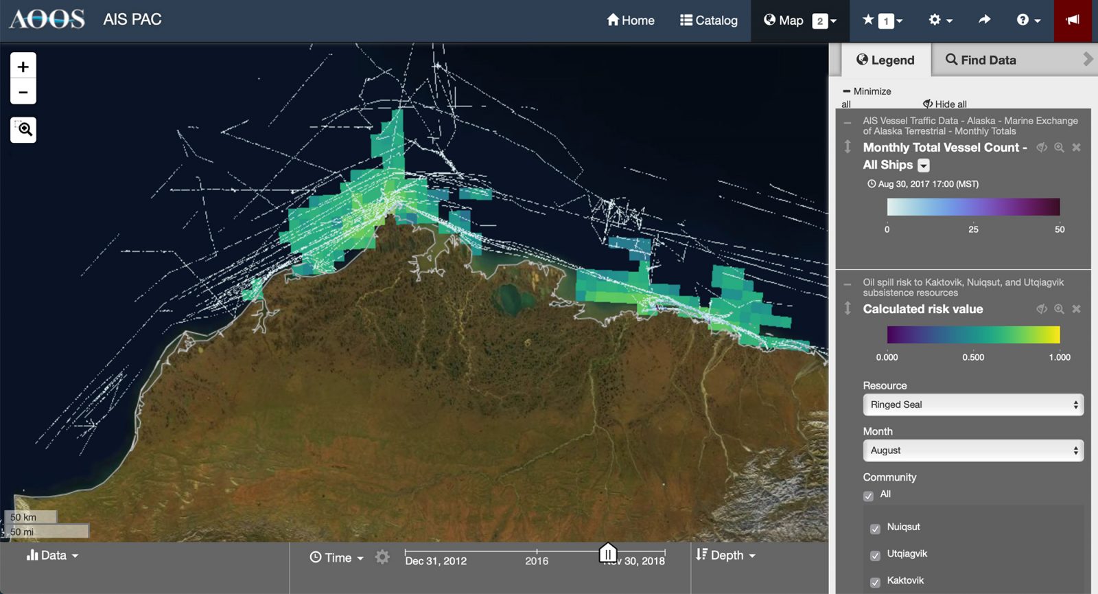
Here, vessel traffic areas with the highest potential impacts were assigned a risk value based on hazard and vulnerability:
- Hazard is environmental risk to a region from oil spills
- Vulnerability is the social value assigned to the region for the given resource.
Resources
- Project overview- Synthesizing AIS subsistence & oil spill models [pdf]
- 2017 Annual Impact Report [pdf]
- 2016 AOOS eNews [pdf]
- 2019 AOOS Winter Update [pdf]
Principal Investigators

Alaska Ocean Observing System

Axiom Data Science
Stephen R. Braund & Associates